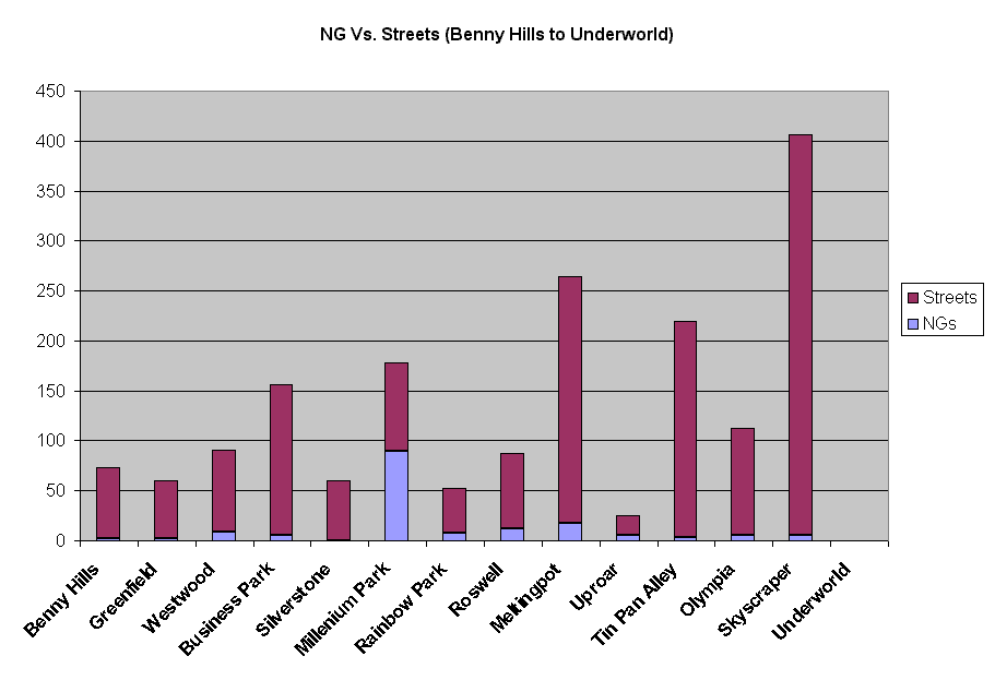
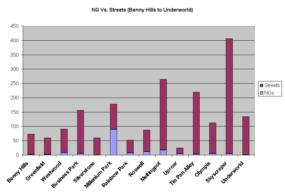
Throughout my conversations with the various Neighborhood Guide Program Administrators (NGPAs) on Neighborhood Guides in the district, I've come across one basic problem I've found very disturbing. We have too little NGs and too many streets.
To illustrate my point, I've compiled the statistics I collected (and am still updating) into two graphs. Both graphs show NG counts and street totals in each district and how they measure up to each other. Graph 1 shows the first 14 districts, and Graph 2 shows the next 12 districts. Kindly note that Wembley and Tattooine have declined to be part of this study. This entire project is in no way sanctioned or monitored by FC. The statistics collected here have been collected for an independent study.
Note: Graphs open up in new windows.
Graph 1 (13.7 kb)
Shows stat comparisons for Benny Hills, Greenfield, Westwood, Business Park, Silverstone, Millenium Park, Rainbow Park, Roswell, Meltingpot, Uproar, Tinpan Alley, Olympia, Skyscraper and Underworld.
Graph 2 (13.5 kb)
Shows stat comparisons for Victoria Park, Lavender Hill, Little Italy, City Pubs, Campusville, the Village, Marina, Oasis, Ballykissangel, Rivendell, Athena and Health Club.